New Technologies in Support of Proglacial Hydrology Study
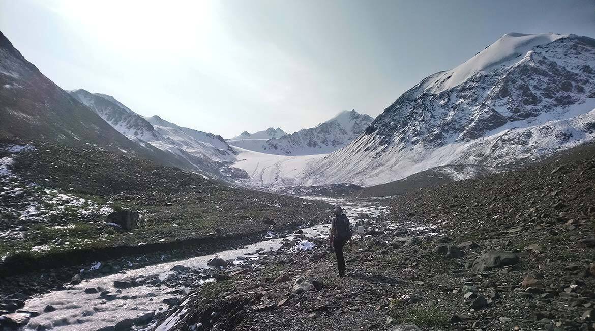
Grizzly Creek Valley, St. Elias Mountains, Yukon. This image is the property of the authors. CC Licence.
The Challenge of Quantifying Cryospheric Changes
High altitude massifs store large quantities of water in solid form, mainly in the glaciers. Under the effect of climate change, these have been losing mass for several decades. Glacial retreat strongly impacts the ecological benefits provided by mountain valleys, specifically water resource availability in downstream areas. In fact, glacial retreat impacts the capacity of glaciers to store winter precipitation and release it in liquid form during the summer.
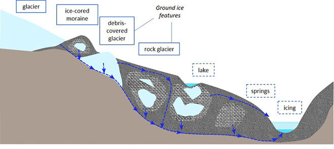
Although they are often the largest ice mass in a glacial valley, glaciers are not the only elements that store water in the form of ice. There are debris-covered glaciers, rock glaciers (mixture of rock and ice), buried ice (remnants of former glaciers that have retreated) and permafrost (permanently frozen ground). These elements, known as “cryospheric,” are also subject to the impact of climate change and their hydrological role is being altered. Difficult to access and often buried under rock debris, these elements are poorly studied and their precise hydrological role is still not fully understood.
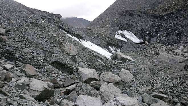
Visible ice on a debris-covered glacier
Difficult Measurements Requiring New Technologies
For the past 7 years, Professor Baraër’s HC3 team has been studying the hydrological behaviour of the St. Elias Mountains glacial valleys in the Kluane First Nations territory of the Yukon. The current research program focuses on a cryospheric formation typical of subarctic mountain valley systems. The formation is located in the Grizzly Creek (or Shar Ta Ga) Valley, Kluane National Park and Reserve. It consists of the cryospheric elements listed above that form a hydrological system, supplying water to streams and aquifers in the valley. These cryospheric features are interdependent in their evolution and in the flows they generate. Thus, the debris-covered glacier forms as the main glacier retreats, and its meltwater could speed up the removal of other cryospheric elements located downstream.
The purpose of studying this formation is to better understand the interactions between cryospheric elements, the system’s hydrological behaviour, and its sensitivity to climate change. Ultimately, the findings of this work will be used to develop hydrological models that can take into account the complexity of these systems and generate more robust projections on the impact of climate change on water resources from glacial valleys.
The Yukon field: a logistical and scientific challenge!
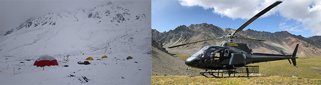
Achieving this goal means overcoming several important challenges, such as the remoteness of the study site. Team and equipment must be transported by helicopter and the scientific program requires camping on site. Ground instability and the possible presence of wildlife at the measurement sites complicate access and travel. Visits are made between June and August to avoid freezing temperatures, but this does not guarantee the absence of snow. Located in a national park, access to the site is limited to 3 weeks per year for a team of 4 people maximum. The measurement instruments left on-site between visits are subject to extreme weather conditions. These instruments must be energy efficient, as the low northern light in winter greatly affects solar panel capacity. Many of the elements under study are located beneath the ground surface, complicating their characterization. Water flows are mainly underground, making them impossible to locate and gauge by traditional hydrological means.
The use of emerging technologies can partially address these challenges. A number of these technologies were originally developed for sectors such as aerospace, military research, and automotive. As these technologies are made available, our team can acquire them for application in our research field.
Drones are a perfect example. In the Yukon, our team uses drones to compensate for the difficulties in accessing the measurement sites. Light, versatile, and efficient in difficult terrain, they are used for 3D imaging, which is invaluable in estimating ground deformations.
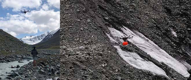
Use of a drone equipped with infrared camera (left) and georadar (right)
Equipped with a georadar, they can detect and measure volumes of buried ice and characterize subsoil structures by locating layers of different compositions.
It is also possible to attach an infrared camera to locate areas of thermal contrast in a torrent to detect groundwater intrusions (colder water), which can then be sampled to identify their origin. With their hydrochemical properties, it is then possible to locate the flow areas.
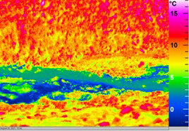
Thermal image of streams (in blue) flowing into the river (in green)
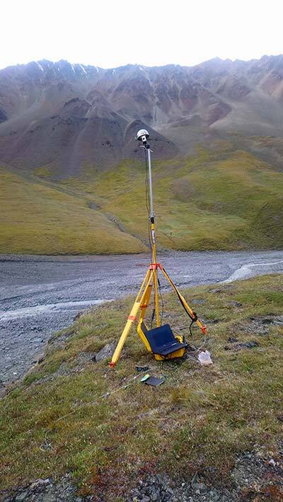
The Lidar flash is another example of technological conversion. This instrument was initially developed to detect obstacles on future autonomous vehicles. Here, it allows us to measure the morphological evolution of an icing—a thick layer of ice forming in winter by groundwater inflow from the system under study. The Lidar emits laser beams toward the targeted area and determines the distance of each reflection point by calculating the travel time of the beam. This produces clouds of tens of thousands of points in less than a second.
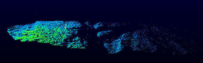
Capture of a 3D point cloud by Lidar
Advanced Technology to the Rescue of Natural Environments
Other than the aforementioned examples, we can see that applying emerging technologies from industry enables research of natural terrain to overcome new challenges. These technologies are helping to better understand natural system functions that provide ecological benefits to communities. As these ecological benefits are strongly affected by climate change, the conversion of advanced technologies to the study of natural environments can be seen as an asset in the development of adaptation measures.